![‘The Descent’ Official Novelization Coming Soon from Titan Books; Read First Chapter Now [Exclusive]](https://bloody-disgusting.com/wp-content/uploads/2020/04/descent-shauna-2.jpg)


![No Stars: A Must-See [THE PLOT AGAINST HARRY]](http://www.jonathanrosenbaum.net/wp-content/uploads/1990/03/ThePlotAgainstHarry-300x168.jpg)
![The Nasty Woody [ANYTHING ELSE]](https://jonathanrosenbaum.net/wp-content/uploads/2011/04/anything-else.gif)


![American Airlines Slammed By Elite Passenger Forced To Fly Economy While Pilots Relax In First Class [Roundup]](https://viewfromthewing.com/wp-content/uploads/2025/05/amercan-airlines-737-first-class-seat-pair.jpg?#)


![United Flight Attendant Leaves Risqué Note for Miley Cyrus’ Ex—”I Was Shakin’ Like a Stripper” [Roundup]](https://viewfromthewing.com/wp-content/uploads/2023/02/ua-fa.jpeg?#)


![[Podcast] Problem Framing: Rewire How You Think, Create, and Lead with Rory Sutherland](https://justcreative.com/wp-content/uploads/2025/06/rort-sutherland-35.png)


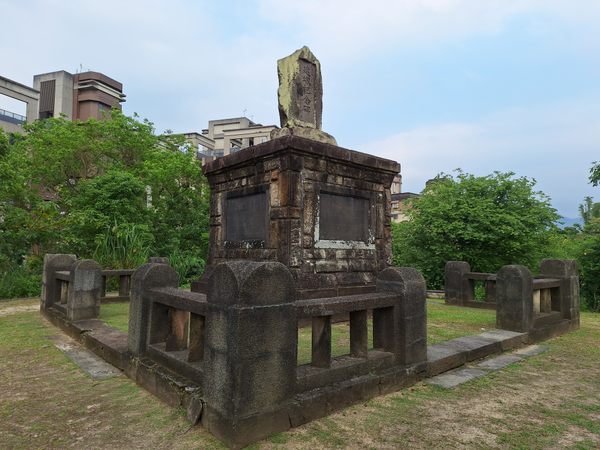
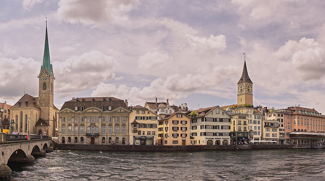
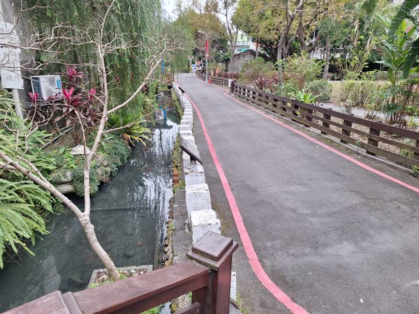
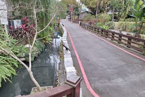
Wulixue Irrigation Canal in Taipei, Taiwan
Local writer Shu Guozhi once described Taipei as a “Water City,” a statement that might seem puzzling to many today, as visible water bodies are rare in the modern metropolis. However, Taipei, situated in a natural basin, was once dotted with irrigation ponds and an extensive network of irrigation canals. In an era before high-rises dominated the skyline, much of Taipei consisted of farmland. If you closely examine a map of Taipei, you’ll notice that many streets and roads deviate from a typical grid pattern, tracing the paths of historical waterways. Most irrigation ponds were drained for urban development, and waterways were buried underground. Remnants of Taipei’s “Water City” era still exist. One such site is the Wulixue Irrigation Canal, located just across the street from National Taiwan University. This open canal segment, approximately 30 meters long, is the best-preserved portion of Taipei’s Irrigation Canals. The surrounding area has been modestly landscaped by the city government, with flowers, willow trees, and a small bridge spanning the canal. The water is clear enough to support koi fish and turtles. Informational signs nearby explain the canal’s history: it was first constructed around 1736, during the Qing dynasty, to irrigate fields in the Taipei basin. By 1984, as urban development replaced farmland, the canal’s irrigation function ended. In 2025, the canal has become an official municipal historic site of Taipei City. Visitors are offered a rare glimpse into the city’s agricultural past here.
Local writer Shu Guozhi once described Taipei as a “Water City,” a statement that might seem puzzling to many today, as visible water bodies are rare in the modern metropolis. However, Taipei, situated in a natural basin, was once dotted with irrigation ponds and an extensive network of irrigation canals. In an era before high-rises dominated the skyline, much of Taipei consisted of farmland. If you closely examine a map of Taipei, you’ll notice that many streets and roads deviate from a typical grid pattern, tracing the paths of historical waterways.
Most irrigation ponds were drained for urban development, and waterways were buried underground. Remnants of Taipei’s “Water City” era still exist. One such site is the Wulixue Irrigation Canal, located just across the street from National Taiwan University. This open canal segment, approximately 30 meters long, is the best-preserved portion of Taipei’s Irrigation Canals.
The surrounding area has been modestly landscaped by the city government, with flowers, willow trees, and a small bridge spanning the canal. The water is clear enough to support koi fish and turtles. Informational signs nearby explain the canal’s history: it was first constructed around 1736, during the Qing dynasty, to irrigate fields in the Taipei basin. By 1984, as urban development replaced farmland, the canal’s irrigation function ended.
In 2025, the canal has become an official municipal historic site of Taipei City. Visitors are offered a rare glimpse into the city’s agricultural past here.